
Vermont’s Long Trail:
It was grueling.
It was anxiety-riddled.
It was way, way, way harder than I ever imagined.
I’d give anything to go back and do it again.
My goal was to solo backpack the 273 miles of Vermont’s Long Trail. Though over the years I’ve shared some of my photos and story of why I was inspired to hike the trail, I’ve never shared pages from my private journal.
So honor this important anniversary, I thought I’d share some of my private musings from my journal pages.
First, a few clarifications:
— Though I’d been backpacking before, I’d never done it alone, nor had I ever attempted such a long distance.
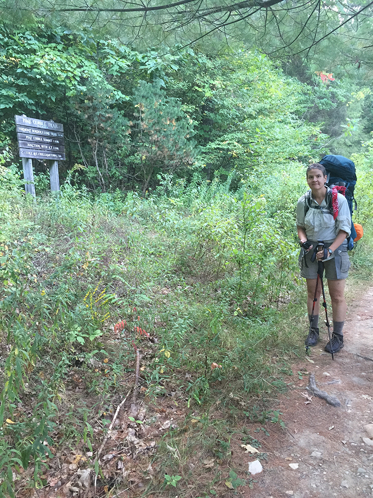
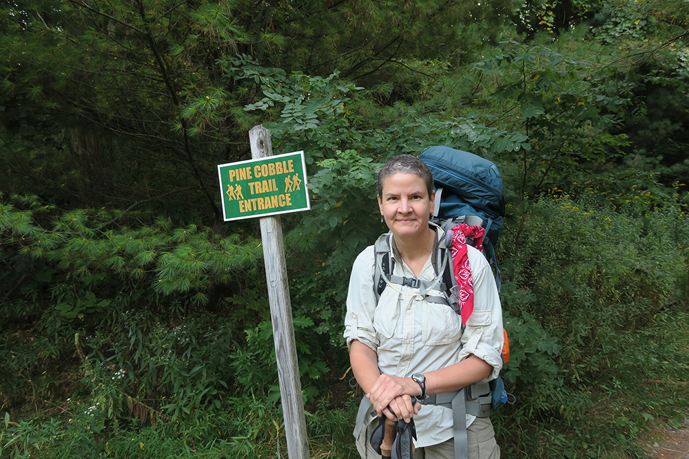
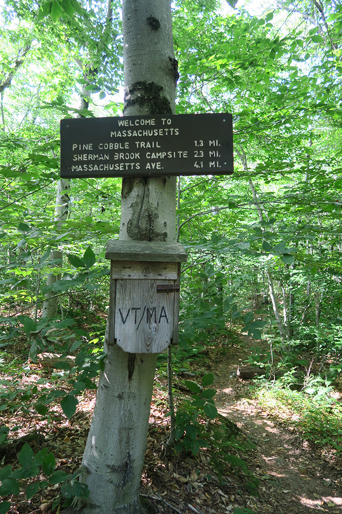
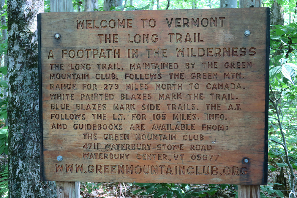
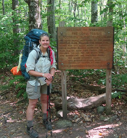
— To get to the southernmost trailhead of the Long Trail (LT), I started in Massachusetts on the Pine Cobble Trail. After 3.3 miles the Pine Cobble meets the Vermont border at the junction with the Long Trail — as well as the Appalachian Trail (AT).
— At the Massachusetts/Vermont border, the AT merges with the LT, and they are the same trail for 105 miles. After 105 miles, at Maine Junction, the Long Trail continues north through Vermont to Canada, and the Appalachian Trail turns eastward to New Hampshire and Maine.
— A thru-hiker is someone who is hiking the whole trail — the full length of it — in one long hike; a section hiker is one who, rather than hiking a long-distance trail in one fell swoop, does a section at a time.
— NOBO = northbound; SOBO = southbound; I was a NOBO LT thru-hiker.
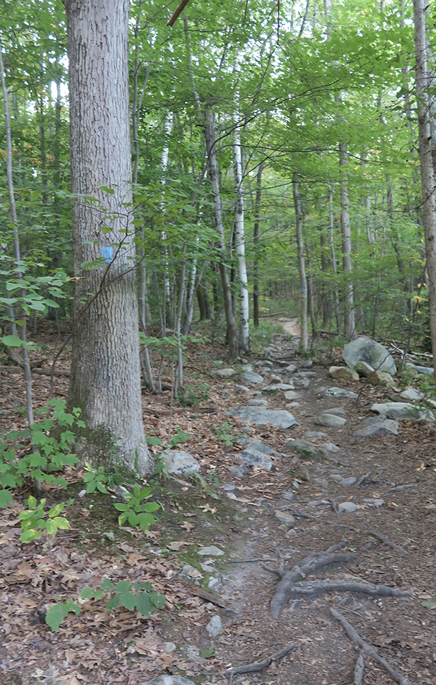
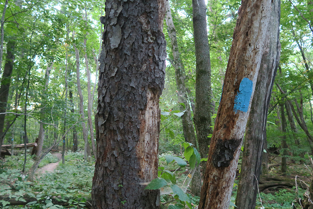
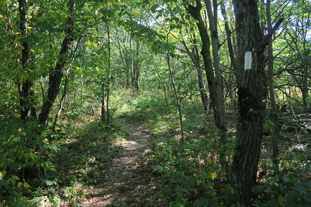
— Both the LT and the AT are marked with white blazes painted along the path. Side trails (like the Pine Cobble) are marked with blue blazes.
— GMC = Green Mountain Club is the terrific organization that protects and maintains the Long Trail and other Vermont trails.
— There are about sixty shelters along the LT, some of which are simple three-sided lean-tos, while others are more elaborate enclosed cabins. Although I carried a tent, my plan was to stay in a shelter whenever I could. Even hikers with tents though often camped near the shelters, as there was almost always a water source nearby, as well as the comradery of other hikers.
— Each shelter has a log book, where hikers share their reflections, trail conditions, and often notes to each other. In each book that I logged into, I left a tiny colorful card (1.5″ x 1.5″) with a detail of one of my paintings and a quote by Rumi.
— Nearly every thru-hiker and section-hiker adopts a trail name. Mine was (surprise!) TaosDawn.
Now then…. Come, hike with me across Vermont:
Study nature, love nature, stay close to nature. It will never fail you.
— Frank Lloyd Wright
Knowledge is only a rumor until it lives in the muscle.
— Brene Brown (quoting a saying of the Asaro tribe of Indonesia)
September 9, 2015 — Day One of The Long Trail — Wednesday
3:00 and I am alone in my first home on the LT. Heather dropped me off at Pine Cobble trailhead at 7:45.
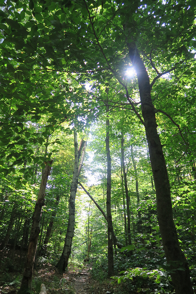
I think we were both trying hard not to cry. Six miles into this and it is exactly as I expected it: Hard. I don’t care how far above sea level I am, uphill with a pack is uphill with a pack! It seems to me any gain from hiking at altitude is completely trumped by humidity, which today — at 90° — has been utterly wilting, the sweat gushing from my brow and neck. These first few days are going to be a serious test.
Today, sunny, hot and very humid; tomorrow heavy rain — on one of my longest days. Trying to keep a positive attitude and not fret about tomorrow: just focus on today and be in the moment. But the truth is I’m scared about tomorrow.
Deep breath.
One day at a time.
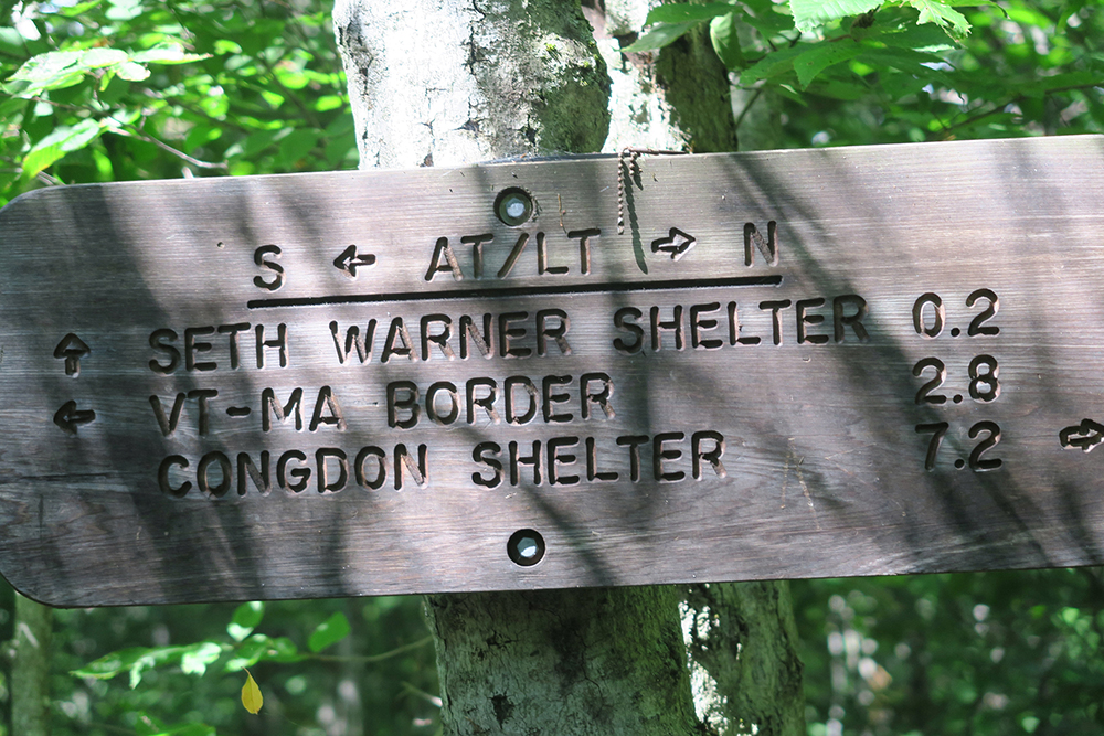
Last night when I checked the weather and looked at the map I thought of bumping up my hike today and aiming for Congdon Shelter rather than Seth Warner, which would have made for a 13 mile hike today rather than tomorrow. But everyone I’ve seen hiking today seems younger, faster and with a lighter pack. And the heat is debilitating, My concern is that I would have gotten into camp so late, that there would be no room for me. So better, I think, to stick to my original plan. I’m concerned, too, by the fact that today, at least, I was slower than the GMC estimates. They had 4 hours from Pine Cobble to SW, and it took me almost 5. I don’t want to obsess about my speed…BUT… a 13-mile day tomorrow with a couple of SERIOUS ascents in HEAVY RAIN has me concerned.
Would do well to keep in mind Rumi:
To be self-conscious is to worry about everything but . . .
What will be will be.
~ Rumi
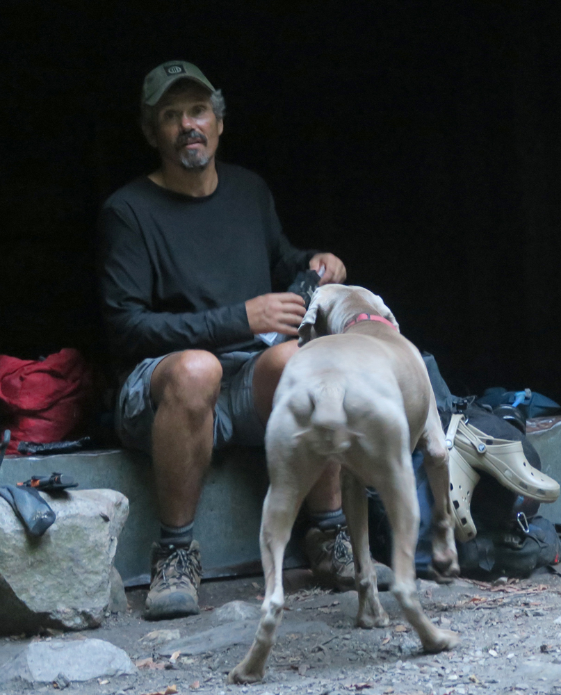
Just after 7:00… The rain started about 10 or 15 minutes ago … lounging in the shelter with a young couple from WI — Bear Hookah & Lovel — and Barnum (whose dog, Bailey — a beautiful four-year old weimaramer — is crashed in his tent).
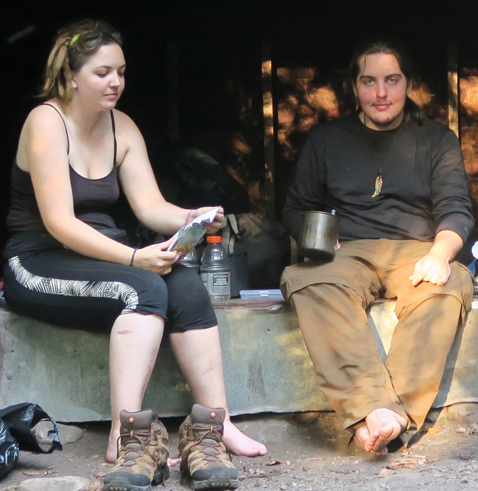
These are my favorites of the people I’ve met today. When I got to the Vermont border — and the start of the Long Trail — a young woman, Lauren, and her friend hiked up, on her way to thru-hike. Half my age, she also appeared to be carrying half the weight that I’m carrying. A few minutes of visiting and picture-taking, then I took off to give them a chance to bid their goodbyes — after they checked their cell phone messages (!). Thirty minutes later she passed me for Congden.
Now that I think of it though, the first people I encountered were a couple of day-hikers — two tall, baldish men who barely acknowledged me. They were deep in conversation about the Bible. A little later a couple of other similar looking men, who were gracious, thanking me for stepping aside so they could pass, and wishing me well. A little later, three AT section hikers headed south — seemed college-aged. After that, no one until — Finally! I made it to Seth Warner Shelter.
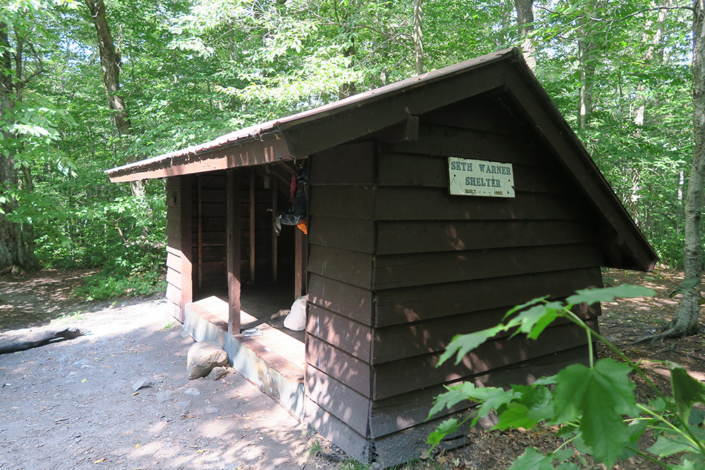
A lovely young man greeted me. He was taking his lunch, having started a northbound LT hike today as well! His name is Justin from RI, originally but most recently from Maine. And he’s been to Philmont! We visited for a nice short while, when he finally pushed on, hoping to make it to Congdon.
Next to show up was “Running Moose” from Kansas. SOBO AT hiker headed to GA. He looked like a child! But had a red beard and a great deal of chest hair brimming from his shirt (!) Had a purple sash tied around his head and was very soft-spoken and thoughtful. Thought before he spoke. Contemplative. Very pleasant.
I then had an hour or two to myself after he left, during which time I got water, played my flute, wrote, sketched and relaxed. Next to arrive were Barnum & Bailey. Barnum is a former army dude turned philosopher/hiker. Says he was a real “Reagan Republican” until the Bush years and serving in Iraq. Now he’s a diehard liberal; good fun to talk with and listen to, and his pup — Bailey — is a sweetheart.
These mountains or the oldest in the world.
There’s magic in these mountains.
I can guarantee you that.
~ Barnum
September 10, 2015 — Day 2 — The Long Trail, Vermont
A short heavy shower last night at 6:00. A few other hikers showed up for water and shelter from the rain. But only two of us slept in the shelter: Bear and me. All hit the hay by dark and, despite rolling around a lot, I slept pretty well. Up to pee twice. Then up with my alarm at 5:45. Lesson learned: load up on the day’s water the night before, as I went through water faster than expected and had to fetch more in the morning.
Broke camp and on the trail by 7:20 — a little later than I’d hoped. The morning started with a gradual but challenging uphill and deep humidity and heat. Honestly? I was miserable, fighting self-doubt and worry about the 13 miles ahead and forecast of heavy rain. A couple of hikers passed me — a woman about my age and a much younger college-aged man. Mother & son doing a section of the AT. After about 45 mins I decided to put away my watch — something I will do every day now once I hit the trail. A reminder from my Rangering days that
YOU’RE ALWAYS ON TIME
And…
YOU’LL GET THERE WHEN YOU GET THERE —
NOT A MOMENT SOONER AND
NOT A MOMENT LATER
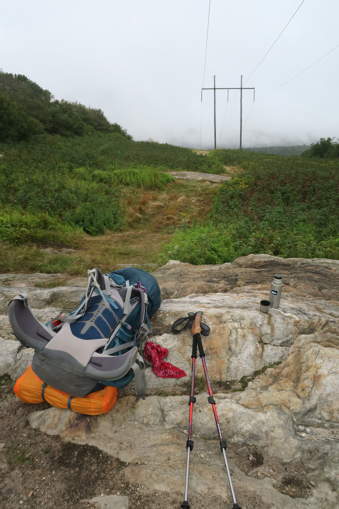
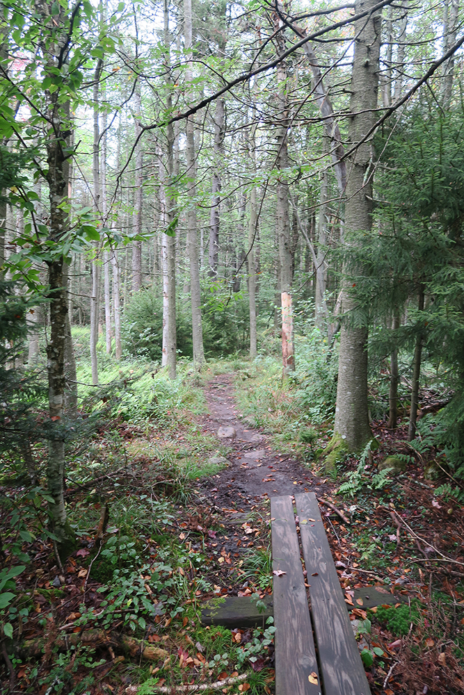
Was feeling uneasy and anxious, when I came to a side trail to a spring. Even though I didn’t visit the spring, for some reason it cheered me — just having a place on the map that I could identify lifted my spirits. Soon after that I climbed to a high clearing under power lines. The clouds were low so I couldn’t see very far, but still, I could see the sides of distant mountains. I decided to stop and have some tea and study my map. I felt instantly at peace and satisfied…
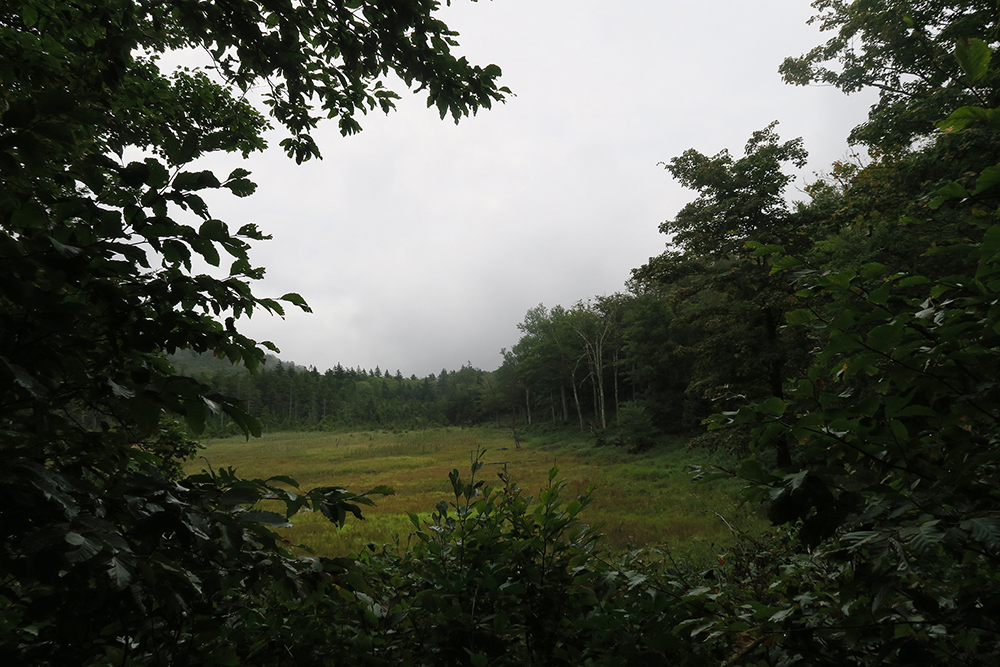
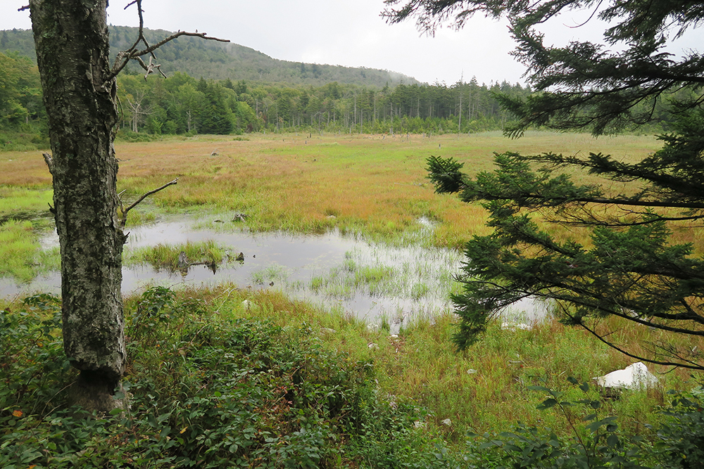
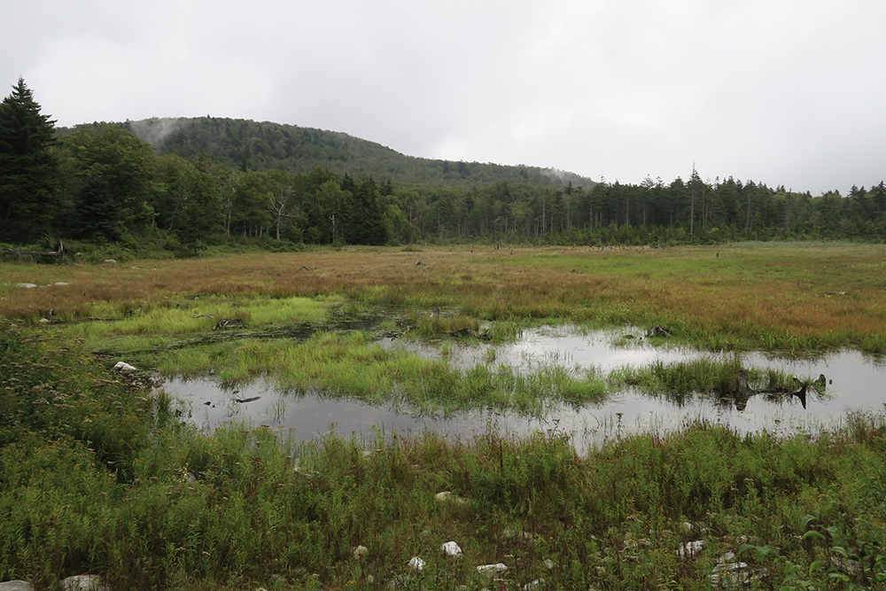
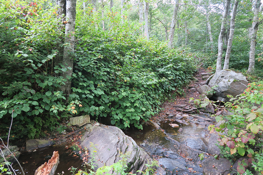
Eventually this day I made my way beside a beautifully marshy pond. The sky was overcast all day, but no rain in the morning, at least.
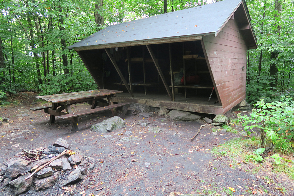
By midday I was beside the beautiful Stradford Stream, where I dined at Congdon Shelter with “Smoky” a NOBO AT hiker who was sitting there, rather mellow, having a cigarette (!!) After lunch I decided to push on as planned and head to Melville Nauheim Shelter. Smoky commented “It’s a beautiful day isn’t it?” And I realized, yes, it is. Overcast, cooler and no rain — it was beautiful.
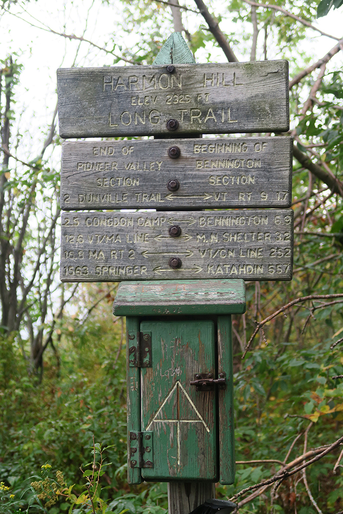
Eventually a couple of light drizzle showers passed through, but barely enough to require a rain jacket. The last descent of the day was down Harmon Hill — very steep down long slick stairs. I had to walk very carefully, as the moss, leaves and rocks — all damp — were incredibly slick. And I did slip at least once, landing on my right thigh, smashing my camera that was in my thigh pocket. So much for the camera image screen — now badly cracked (camera still works).
Made my way to Route 9 — the highway to Bennington — the bridge across the Walloomsac River. I was just making my way up the first “staircase” when a local man out for his evening walk came up behind me and said that a week ago the stream at MN shelter was dry — he encouraged me to get water at the river. Forty-five minutes later….. I had gotten water AND left a note at the bridge sign alerting others of what the man told me. Halfway up the steep steep part — some time later — he was coming back down. “This is the worst of it — you’ve got it Girl!” He also said the water at MN was still quite scarce.
Later, when I got to MN there was water — even a little trickle to it. He must not understand that, as far as I’m concerned, just about any water is good water. As I approached the shelter, a young man looked up and said in a cheerful voice, “Hello Dawn!” It was Justin, my fellow NOBO thru-hiker whom I met on Day One! Such a delightful soul and good, cheerful company.
Dinner done and cleaned up by 7:30 and in bed by 8:00.
And NOW the rain came. It rained and rained and rained all night long.
And cleared up come morning.
If you desire the self, get out of the self.
Leave the shallow stream behind
and flow into the river deep and wide.
Don’t be an ox pulling the wheel of the plow,
turn with the stars that wheel above you.
~ Rumi
Thank you for being here and reading my musings.
If you enjoy my posts I invite you to subscribe to this, my blog so you catch all my occasional musings. And by all means, if you know others who might enjoy these writings, please feel free to share this post with them.
Meanwhile, find more of my stories, insights and art here on my website, www.taosdawn.com. Peruse and shop for my art here. And please consider joining me for TuesdayDawnings, my weekly deep breath of uplift, insight, contemplation & creativity.
Thank you again!
Stay safe. Be kind.
~ Dawn Chandler
Santa Fe , New Mexico